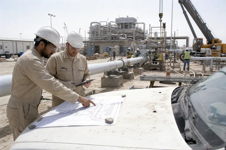
In Saudi delivery teams that need current ground truth, construction drone surveying Saudi Arabia is best treated as a repeatable site-capture workflow, not a one-off flight. A drone-based approach can address the same pain points seen in manual surveys: manual methods can provide only a partial picture of onsite materials. That makes it harder to manage a materials management plan (MMP). Inaccurate volume calculations can lead to costly over- or underordering of aggregates, inefficient reuse of material, and compliance challenges with environmental regulations. These risks can be amplified on large developments that can comprise hundreds of plots.
A practical workflow starts with capture, then turns imagery into usable engineering outputs. Drone Surveying describes a digital, drone-based survey and consultancy service that uses photogrammetry and a secure online portal to capture, analyse, and manage earthworks data. Each flight collects high-density survey data across the whole site. The data is processed into an accurate digital terrain model and orthomosaic imagery. It is then run through a volumetric analysis workflow to calculate the volume of every accessible stockpile. After that, engineers enrich the dataset by naming and categorising stockpiles, tagging location and intended use, and aligning outputs with the client’s MMP.
Workflow ROI in Earthworks and Site Control
ROI in drone surveying is often created by avoiding preventable cost and coordination churn, rather than by chasing a single headline metric. When volume calculations are inaccurate, teams risk over- or underordering aggregates and losing reuse opportunities for topsoil and subsoil. A high-density, whole-site capture that produces a digital terrain model and orthomosaic can support repeatable measurement and clearer review cycles. The enriched, categorised stockpile record also creates a clearer, auditable record of materials, which supports planning and environmental compliance. In parallel, wider construction automation trends point at the same direction: reducing time spent gathering site data so teams can focus on higher-level decision-making.
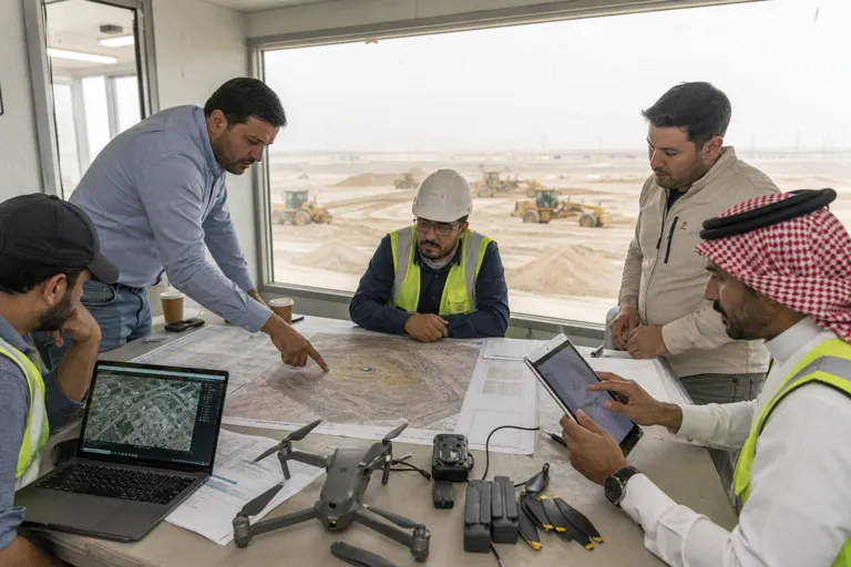
Saudi projects also depend on connected delivery teams and consistent digital outputs. Gulf Business Solution (GBS) stated it has trained and certified over 60 Saudi engineering professionals in advanced digital project delivery workflows. It cited hands-on expertise in Autodesk Construction Cloud (ACC), Revit, AutoCAD, and Navisworks, among other integrated solutions. For drone site capture, this matters because the value is realised when outputs are shared and acted on, not just stored. A secure online portal approach, combined with digitally enabled teams, supports faster handoffs between survey, engineering, and construction controls.
A practical GACA compliance map should be part of the workflow definition, even before the first flight request is raised. GACA is actively shaping the aviation market, including reforms such as abolishing cabotage flight restrictions for air charter operators in May, and a General Aviation Roadmap that aims to create 35,000 jobs in the sector by 2030. For construction drone surveying, teams should treat this as a signal to operationalise compliance: define roles, document flight intent, standardise how site captures are stored and shared, and ensure the organisation can show an auditable chain from capture to decision. The goal is predictable site capture that is usable by project leadership and defensible for compliance conversations.
Finally, site capture has to scale to the reality of Saudi megaproject delivery. Diriyah’s next phase includes more than 55km of streetscapes, and Parsons’ role there is backed by a $56m five-year contract for design and construction supervision. That scope illustrates why repeatable, whole-site capture matters: linear assets, public realm works, and fast-moving interfaces benefit from current terrain and imagery, plus clear material tracking. Drone-based earthworks and stockpile workflows provide a structured way to keep the site model current and help teams align field conditions with planning intent.
What is construction drone surveying Saudi Arabia used for on site?
How does drone surveying support an MMP?
Where does ROI come from in a drone earthworks workflow?
What is a simple GACA compliance map for construction site capture?